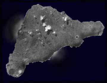
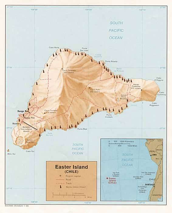
Easter Island is the world’s most isolated inhabited island. It is also one of the most mysterious. Eastern Island is roughly midway between Chile and Tahiti. The triangular shaped island (Easter Island) is made mostly of volcanic rock. Small coral formations exist along the shoreline, but the lack of a coral reef has allowed the sea to cut cliffs around much of the island. The coastline has many lava tubes and volcanic caves. The only sandy beaches are on the northeast coast. Easter Island we think of of huge stone carved figures – Easter Island Stones (or Eastern Island Stones).
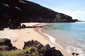
Ovahe Beach, North Shore
The inhabitants of this charming and mysterious place called their land: Te Pito o TeHenua, ‘the navel of the world.’
It sits in the South Pacific Ocean 2,300 miles west of South America, 2,500 miles southeast of Tahiti, 4,300 miles south of Hawaii, 3,700 miles north of Antarctica. The closest other inhabited island is 1,260 miles away – tiny Pitcairn Island where the mutineers of the H.M.S. Bounty settled in 1790.
Archaeological evidence indicates discovery of the eastern island by Polynesians at about 400 AD.
In 1722, a Dutch explorer, Jacob Roggeveen, sighted and visited the island. This happened to be on a Sunday, Easter Sunday to be precise, and the name stuck: Easter Island (Isla de Pascua in Spanish).
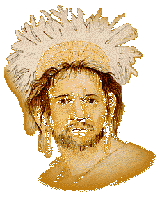
What he discovered on Easter Island were three distinct groups of people, Dark skinned, Red skinned, and very Pale skinned People with red hair”.
The Polynesian name of the island is Rapanui, which is a name given by a Tahitian visitor in the 19th century who says that the island looked like the Tahitian island of ‘Rapa,’ but bigger, ‘Nui.’
Inhabitants are of Polynesian descent, but for decades anthropologists have argued the true origins of these people, some claiming that ancient South-American mariners settled the island first.
What many early explorers who visited the easter island found, was a scattered population with almost no culture they could remember and without any links to the outside world.
The Easter islanders were easy prey for 19th century slave traders which depreciated even more their precarious culture, knowledge of the past, and skills of the ancestors.
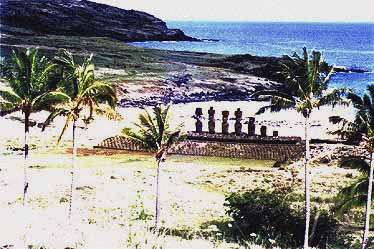
THE MOAI
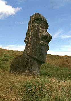
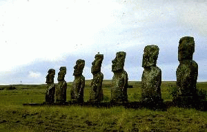
When we think of Eastern Island we think of of huge stone carved figures -monoliths- that dot the coastline.
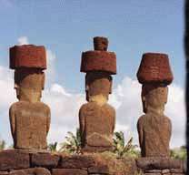
They are called Moai and are carved from island rock.
The Moai are seen all over the island, and in different shapes, sizes, and stages of completion. Many Moaiare left unfinished at the quarry site. No one is sure yet as to what purposes did the Moai served, but outside scholarly research together with accumulated local knowledge, shows evidence that the Moai were carved by the ancestors of the present inhabitants.
Ron Fisher in his work Easter Island Brooding Sentinels of Stone, mentions as one explanation for the statues that “two classes of people, the-so-called Long Ears and Short Ears, lived on the island. The Short Ears were enslaved by the Long Ears, who forced the Short Ears to carve the Moai. After many generations and during a rebellion, the Short Ears surprised the Long Ears killing them all, which explains the abrupt end of the statue-carving.
Long Ears
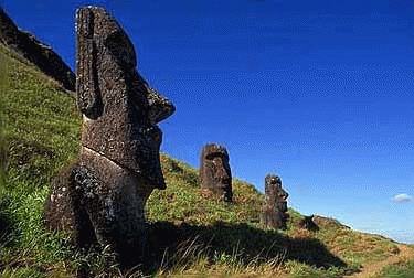
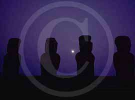
Some of the Moai face the sea –
most face inland to watch over the villlages.
Many of the were buried up to their shoulders and thereby appearing as disembodied heads.
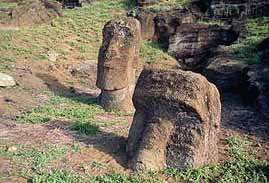
All of the Moai were toppled in tribal wars about 250 years ago.
Many have recently been rebuilt – starting in the 1950’s.
They sit on rocky lava strewn about telling a story of fallen monuments of a long lost civilization who created them. The Moai were depictions of their ancestors. The Rapa Nui were ancestor worshipers and only had one diety – Make Make.
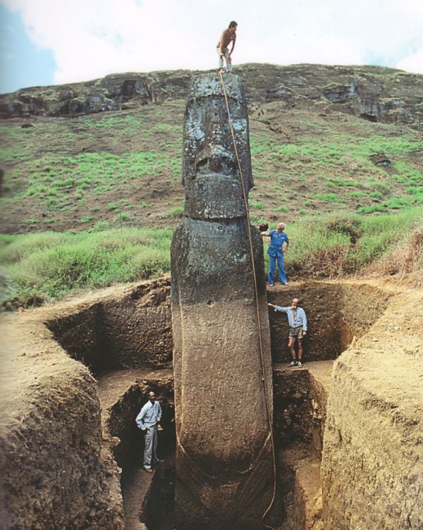
The Moai were excavated for the first time by Thor Heyerdahl in the 1950’s and were photographed at that time.
AHU
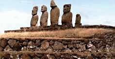
Moai sit on platforms – ceremonial shrines called Ahu.
Ahu Akivi is an especially sacred place.
Ahu Akivi is a sanctuary and celestial observatory built about 1500 AD which was the subject of the first serious restoration accomplished on Easter Island by archaeologists William Mulloy and Gonzalo Figueroa, with excellent results. As in the case of many religious structures on Easter Island, it has been situated with astronomical precision: it’s seven statues look towards the point where the sun sets during the equinox.
It is also aligned to the moon.
Ahu Akivi is an unusual site in several respects. A low ahu supports 7 statues all very similar in height and style. The site is odd in that it is located far inland and the statues were erected to face the ocean. The only site where this was done. Like other Easter Island sites the statues were found knocked off the ahu, lying face down in the ground. In 1960, Archeologist William Mulloy’s team spent several months raising the statues to their original positions.
During the excavation and restoration of this site many cremation pits were uncovered behind the ahu. The pits contained fragments of bone, shells, fishing implements, and obsidian flakes. Whether sites like these were used regularly for cremations and or burials is not certain. At other sites skeletons have been found buried within the ahu structure, but these burials are believed to have occurred after the statues were toppled.
Folklore holds that its seven moai represent the seven young explorers that legend says the Polynesian King Hotu Matu’a dispatched from across the seas, probably from the Marquesas Islands, to find this new homeland for him and his people. They are among the few moai that face the sea.
These seven stone giants may well symbolize those seven explorers, but no one knows for sure. Just as no one knows what any of the moai really represent or why only a few of them face the sea.